Over seventy Wickham History Society members and visitors came to hear Jeremy Clutterbuck of Cotswold Archaeology report back on the archaeological excavations on the “South Glebe” – the area behind School Road, where the new roundabout has been built.
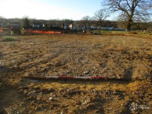
View north-west to Wickham down line of Roman Road
Wickham’s Roman Road
Jeremy confirmed that the line of the roman road had been identified, with a section of the “agger” (embankment) exposed during the excavation. It was close to but not on the alignment shown by the Ordnance Survey. It looks as though it may have been moved at some point as there is also evidence of another road close to it. At one point it disappears, perhaps due to soil movement on what is a very wet site. There is a row of postholes that look as though they follow the road for a section – Jeremy speculated that this could perhaps indicate part of the road that was built up on a causeway over wet ground.
The road crosses School Road close to the entrance to Wykeham Fields and then goes through the Water Meadows before dividing on or close to the golf course with one road going to Bitterne and one to Winchester.
Pottery by the pallet!
Katie, the Cotswold Finds Officer, had brought examples of roman pottery found on the site. She has been working on identifying two pallet loads of pottery from the site so it was still “work in progress” but the finds showed that Wickham was an important source of local pottery manufacture, making their own designs and also copying popular New Forest and even overseas pottery. She had identified batch numbers marked on pots to show firing dates or times and hopes she will even be able to identify at least one potter working over 1,700 years ago known from other work at Rowlands Castle!
Changing uses of the Glebe
The excavations had found a pre roman bronze age barrow – cut through by the roman road. This shows this site, close to the river and with its own stream to the south, has always been a popular settlement spot. During the roman period it looks as though there were more buildings and activity (such as pottery production) during the 1st and 2nd centuries AD, but that by the 3rd century the site was becoming more agricultural and open with evidence of scrub developing.
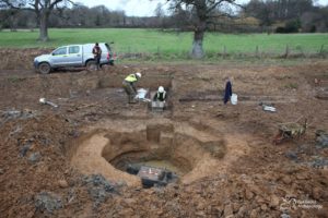
View across north well
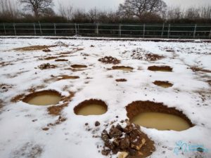
There are a series of very substantial postholes grouped close together which might indicate the site was used for grain storage at one point. There are also a very large number of lined and unlined wells and a very well preserved wood lined tank (probably for fermentation), so it may well also have been used for the production of beer or other grain based drinks, either at the same time as the pottery production or perhaps following on from it.
More to come!
One of the mysteries of the site is the lack of metal or animal bone finds. This might be due to poor preservation because of the wet ground conditions but perhaps other production, referred to in earlier archaeology reports was taking place north on the roman road in the area of the Glebe that is to become public open space? Jeremy suggested that a community archaeology project could find out more.
The scale of finds, and the fact that some archaeology work is still continuing in the area by the stream where the access road is being built means that the final report has not yet been completed. Cotswold Archaeology are reviewing whether there may be enough material for a book, particularly on the pottery finds – so watch this space for follow up talks and publications. You can see more about Cotswold’s work on their website: https://cotswoldarchaeology.co.uk/
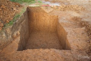
View east across structureSleeping pit
All images courtesy Cotswold Archaeology
Do you have something to contribute to the society?
We use cookies to ensure that we give you the best experience on our website. If you continue to use this site we will assume that you are happy with it.OkCookie Policy